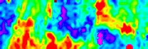
We completed three grids of resistivity on Wednesday, August 8. The results are pretty good.
What we are looking at is a 20×60 meter area, with the bottom left being the SW corner. The areas in red and yellow are areas where there is a lot of brick and/or stone. The areas on blue are areas where there is less rubble, and more soil. There are some clear lines, and our next job is to figure whether these lines correspond to any of the buildings that were located in that block. I have a feeling the line on the far west side is a foundation.
