The block that we are researching has a landscape history extending back to the 1860s. The block has seen dramatic change over the last century and a half, and what makes this research interesting is that we have a number of pieces of evidence that allow us to rebuild the chronology of settlement within that time frame. On this page we will post some of the photographic evidence, working backwards in time. This page will be updated to make it a bit more clean!
________________________________________________________________________
The area was cleared in the late 1950s and early 1960s as part of a wider demolition of the neighborhood to the east of the University. By the mid-1960s, Ritter Hall was built.
________________________________________________________________________
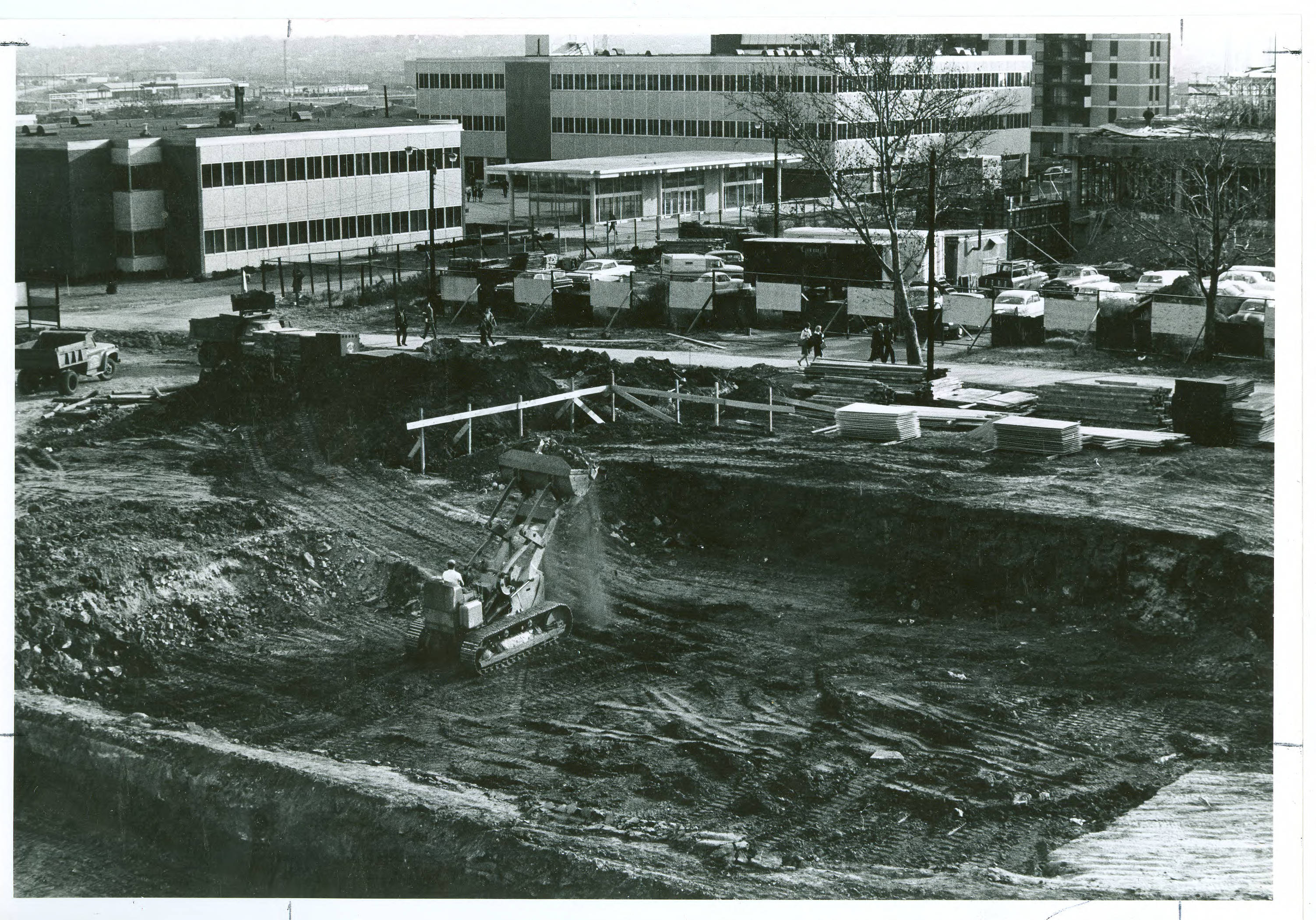
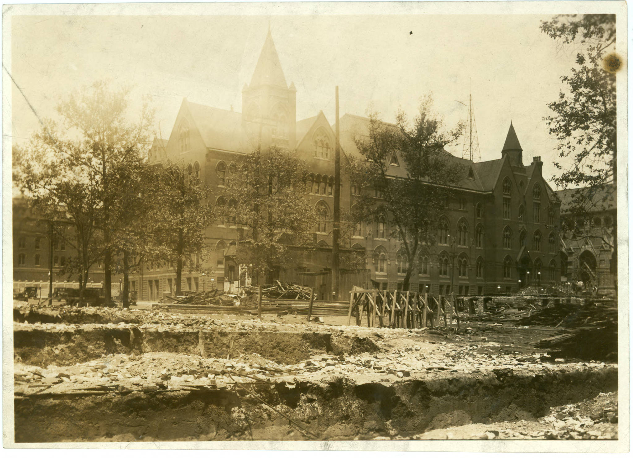
The construction of Ritter Hall can be seen here. The foundation excavation for the building is evident, as are the foundations of other buildings to the east.
________________________________________________________________________
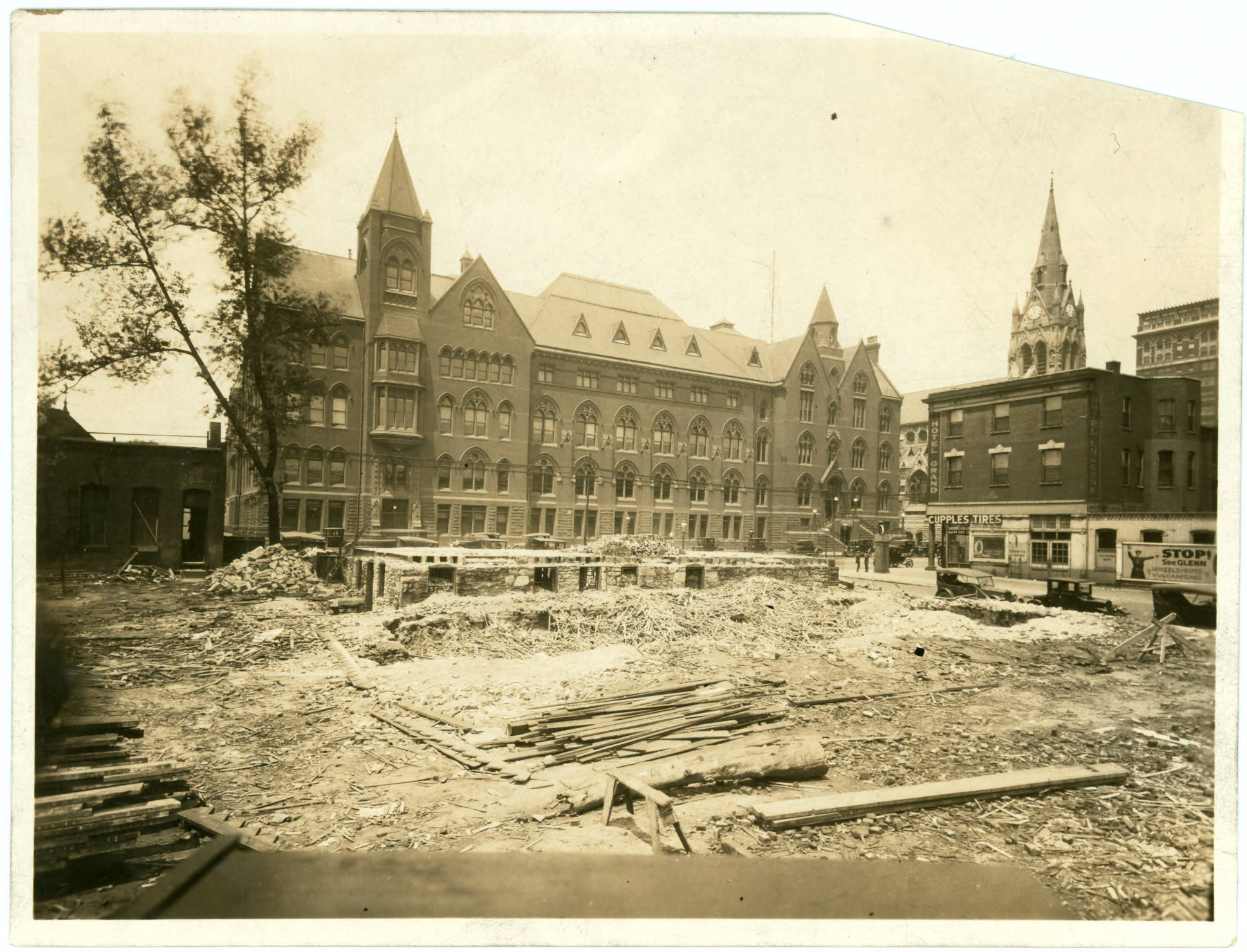
The demolition of the neighborhood to the east of the university took place in a seemingly haphazard manner. Below are photos of the various stages of demolition, looking west back towards DuBourg. Again, note that as the buildings are destroyed, the foundations are left in place, with much of the material from the building being use to fill in the foundation.
________________________________________________________________________
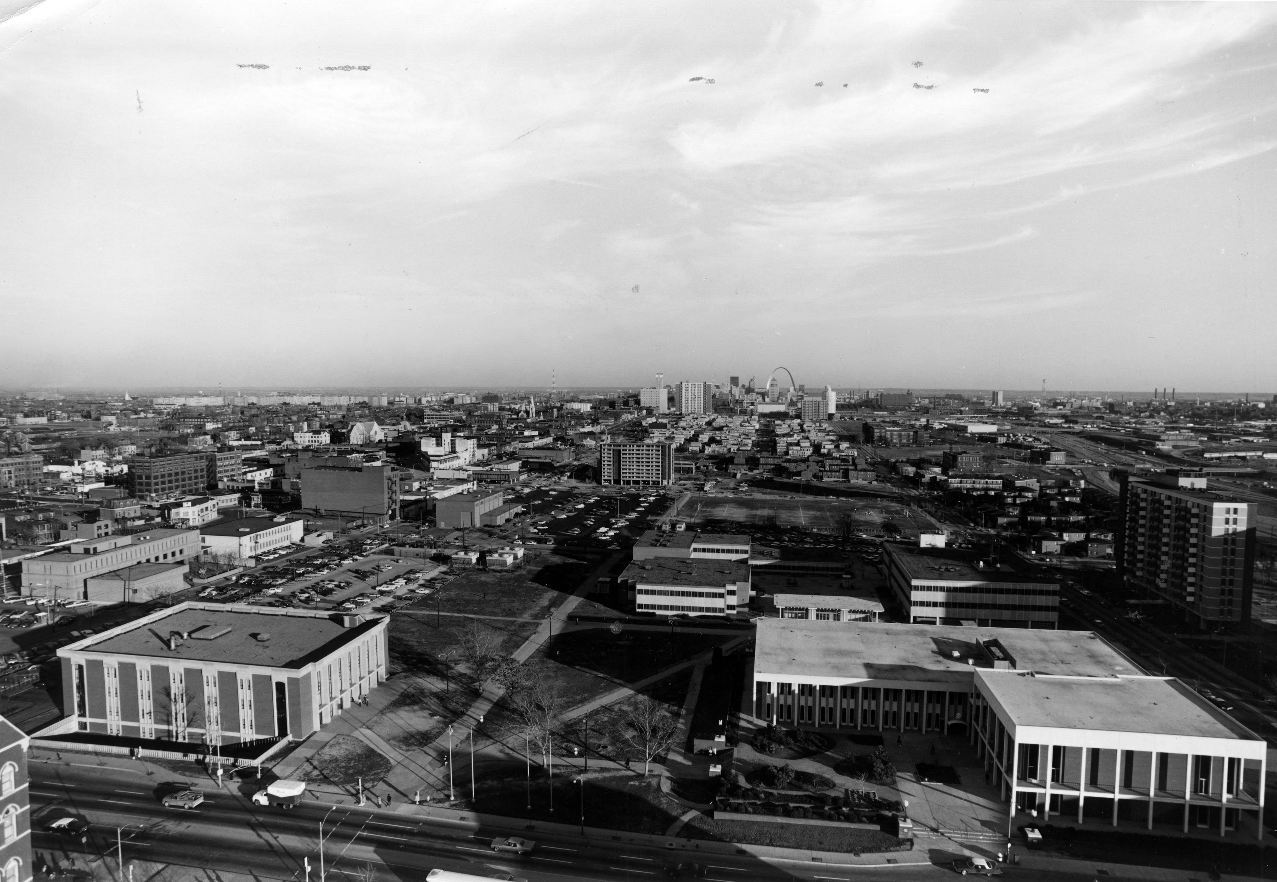
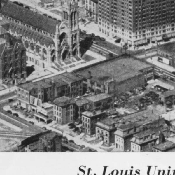
Aerial views of the block from the same era show that many of the buildings on that block were either vacant or derelict, and much of the area was used for parking.

________________________________________________________________________
In this 1932 aerial photograph most of the buildings in the neighborhood are present. Houses on Lindell have been converted to automobile shops and parking lots.
________________________________________________________________________
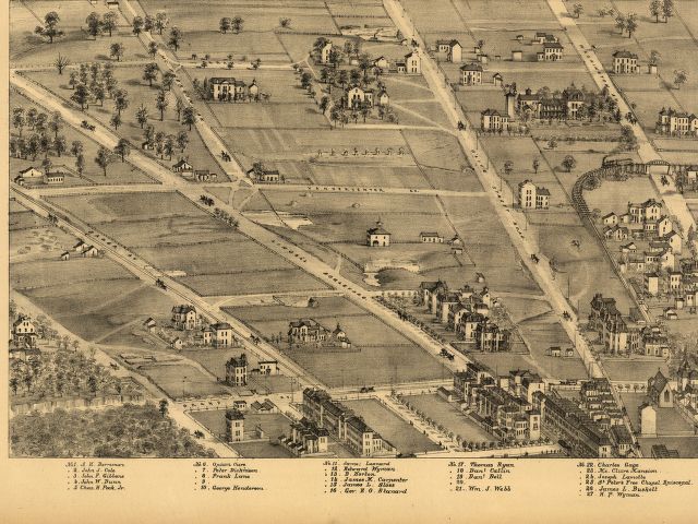
While not a photograph, the 1879 3D atlas of St. Louis shows that at that point some houses had been built between the Camp Jackson Affair and 1879, but that the houses on Pine did not yet exist.