Through a special summer research grant at SLU we purchased a Frobisher Magnetic Gradiometer to round out our suite of archaeological geophysical exploration tools. What is a gradiometer? Put simply a gradiometer measures variance in the magnetic quality of soil and materials in the soil in relation to the surrounding magnetic pull of Earth gravitation (or something like that!). It measures fluctuations of a minute quality, and when graphed, we can see silted ditches, pits, fire places, ferrous metals, walls, and fluctuations in the background earth geology.
Our first go with the gradiometer yielded good results on our 20x60m survey area:
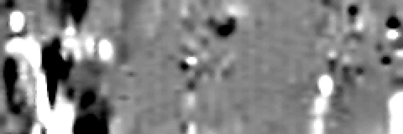
There is a lot going on here, particularly in the western part of the survey area. I have to fine tune that a little bit, but just looking at it it would appear that there are a number of “hot spots” that we can investigate, some of them linear, like that line of white in the eastern third.
Whats interesting too is that there are areas with very little that is remarkable, and those areas compare with the resistivity as well. No conclusions or even hypotheses on this yet, but this gives us some ideas of where to work in our limited time frame.